The 10 best tools for ship tracking in 2026
What this article covers:
- Who uses ship tracking tools and why they're essential for maritime operations
- The data infrastructure powering modern vessel monitoring platforms
- Key selection criteria for evaluating ship tracking software
- Enterprise features that drive operational efficiency and cost reduction
- Comparative analysis of leading ship tracking tools in 2026
- How global AIS coverage and analytics separate industry-leading platforms from basic trackers
Who uses ship tracking tools?
Ship tracking software serves distinct operational needs across the maritime value chain:
- Fleet operators rely on vessel monitoring systems to optimise routing, reduce fuel consumption, and ensure compliance with emissions regulations.
- Ship managers use real-time AIS data to coordinate port calls, manage crew changes, and maintain vessel performance metrics.
- Port authorities deploy ship tracking platforms for traffic management, berth planning, and security monitoring within their jurisdictions. The ability to forecast vessel arrivals with precision directly impacts port throughput and reduces congestion costs.
- Brokers and charterers depend on vessel position data and voyage analytics to identify tonnage, verify fixture performance, and make time-sensitive commercial decisions.
- Maritime analysts and intelligence teams extract strategic insights from vessel movement patterns, trade flow analysis, and sanctions screening.
- Enterprise users require ship tracking tools that integrate with existing systems, support API access, and deliver actionable intelligence rather than raw positional data.
What data powers modern ship tracking platforms?
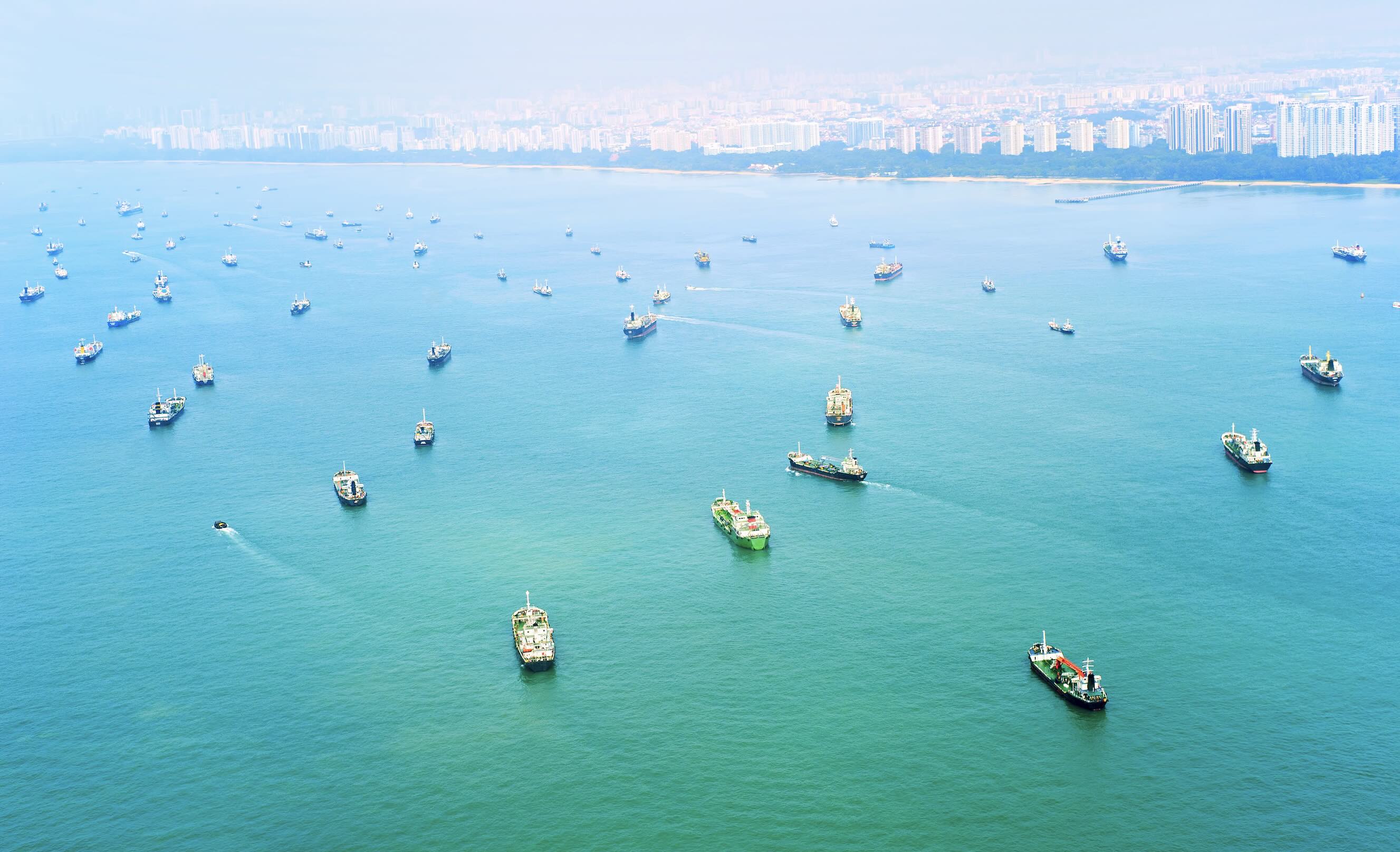
Terrestrial and satellite AIS (Automatic Identification System) forms the backbone of contemporary vessel monitoring. Terrestrial AIS stations capture signals from ships within coastal range, typically extending 40-60 nautical miles from shore. Satellite AIS extends coverage to open ocean areas, providing near-global visibility of vessel movements every few minutes.
Modern AIS coverage goes beyond stationary receivers. In addition to terrestrial and satellite AIS, leading platforms leverage roaming AIS — where mobile receivers mounted on vessels, aerial systems, or partner networks collect AIS signals while in motion. Roaming AIS fills coverage gaps in coastal fringes, straits, and busy chokepoints, and hand-offs data seamlessly between terrestrial and satellite feeds. By stitching roaming data with fixed and space-borne sources, platforms achieve more continuous tracking, reduce blind spots, and improve signal reconciliation and timestamp accuracy across regions.
Leading platforms combine multiple data sources: AIS transponder signals, vessel databases with technical specifications, port call records, and increasingly, synthetic aperture radar (SAR) for detecting vessels operating with AIS disabled. Machine learning algorithms process this data to identify anomalies, predict arrival times, and detect deceptive shipping practices including spoofing and signal manipulation.
The quality of ship tracking software correlates directly with AIS receiver network density, satellite constellation coverage, and the platform's ability to handle signal conflicts in congested waterways. Enterprise-grade systems maintain historical AIS archives spanning years, enabling pattern analysis and compliance investigations.
How to choose the best ship tracking tool?
Evaluating ship tracking software requires assessing coverage, data freshness, and analytical capabilities against specific operational requirements. Global coverage matters for international fleet management, while coastal operators may prioritise high-resolution tracking in specific regions.
Update frequency determines the platform's utility for time-sensitive decisions. Real-time or near-real-time updates (under 60 seconds) support operational dispatch and emergency response. Historical data depth enables trend analysis, while predictive analytics help forecast delays and optimise schedules.
Integration capabilities separate basic tracking tools from enterprise solutions. API access, webhook notifications, and compatibility with fleet management systems, ERP platforms, and business intelligence tools determine how effectively ship tracking data flows into decision-making processes. User access controls, data export options, and customisation features matter for organisations with complex operational structures.
What features should enterprise ship tracking software include?
Advanced filtering and search capabilities allow users to identify vessels by type, flag, owner, operator, destination, cargo capacity, or custom criteria. Multi-vessel tracking with geofencing alerts enables monitoring entire fleets or watching for specific movements within defined areas.
Voyage analytics go beyond simple position tracking to calculate distances, estimate arrival times, analyse route efficiency, and identify deviations from expected patterns. Port call databases provide historical records of vessel movements through terminals, supporting benchmarking and performance analysis.
Risk and compliance features have become essential for enterprise users. Sanctions screening compares vessel ownership, management, and movement patterns against restricted entity lists. Dark activity detection identifies AIS manipulation, ship-to-ship transfers in suspicious locations, and other indicators of deceptive practices.
Modern enterprise platforms must provide comprehensive risk attribution and temporal analysis capabilities. This means identifying which specific risk factors affect individual vessels—whether flag-based restrictions, trade route exposure, ownership changes, or involvement in sanctioned commodities—and tracking how these risk profiles evolve over time. The ability to visualise risk score changes across a vessel's operational history enables compliance teams to identify when vessels became non-compliant, understand risk migration patterns across fleets, and make informed decisions about current and future commercial relationships based on risk trajectory rather than point-in-time snapshots.
Reporting and visualisation tools transform raw tracking data into actionable intelligence. Customisable dashboards, automated reports, and data visualisation capabilities help stakeholders across organisations extract value from vessel monitoring without specialised maritime expertise.
What is the best ship tracking software for real-time global vessel monitoring?
The answer depends on specific use cases, but platforms with comprehensive satellite and terrestrial AIS coverage, proven data accuracy, and enterprise-grade analytics consistently deliver superior results. Global vessel monitoring requires satellite AIS for oceanic coverage, dense terrestrial networks for coastal precision, and sophisticated algorithms to resolve conflicts and gaps.
Real-time performance depends on infrastructure investment. Platforms operating proprietary receiver networks and satellite partnerships typically offer faster updates and higher reliability than aggregators relying on third-party data feeds. Historical data completeness and accessibility matter equally for compliance investigations, market analysis, and operational benchmarking.
The best ship tracking tools balance comprehensive coverage with usability. Enterprise teams need platforms that serve both technical specialists analysing complex vessel behavior and business users monitoring simple operational metrics.
How can ship tracking software improve operational efficiency and reduce costs?
Accurate arrival predictions enable just-in-time supply chain coordination, reducing inventory carrying costs and demurrage expenses. Fleet operators use vessel tracking data to optimise speed, route selection, and fuel consumption based on real-time conditions and contractual obligations.
Port authorities reduce berth idle time and improve throughput by synchronising terminal operations with predicted vessel arrivals. The ability to resequence berthing schedules based on actual positions rather than estimated times prevents costly delays cascading through the system.
Risk mitigation represents another significant cost benefit. Early detection of route deviations, unplanned stops, or entry into high-risk zones allows operators to intervene before situations escalate. Sanctions screening prevents costly violations, while dark activity detection protects against fraud in charter markets and commodity trading.
Commercial intelligence derived from ship tracking reduces information asymmetry in negotiations. Charterers identifying ballast vessels approaching their loading regions gain leverage in rate discussions. Analysts tracking fleet deployment patterns anticipate market movements before they become apparent in lagging indicators.
Best ship tracking tools for 2026
Ranking reflects an editorial assessment based on coverage breadth, update frequency, analytical depth, and integration capabilities.
What makes MarineTraffic one of the leading ship tracking tools?
MarineTraffic operates one of the largest hybrid AIS networks globally, combining over 13,000 stations with comprehensive satellite coverage to track more than 400,000 vessels globally. This infrastructure delivers position updates every few seconds in high-traffic areas and consistent global coverage including remote ocean regions where coverage is often limited across the industry.
The platform serves both operational and analytical use cases through tiered products. The consumer app provides basic tracking for millions of maritime enthusiasts, while MarineTraffic Enterprise delivers the advanced features, API access, and data quality required by commercial operators. Historical AIS data extends back over a decade, supporting compliance investigations and market research requiring long-term vessel movement analysis.
Enterprise capabilities include customisable alerts, fleet dashboards, voyage analytics, and integration options that embed vessel intelligence into existing operational systems. Sanctions screening and dark activity detection tools help compliance teams identify vessels engaged in deceptive practices including AIS manipulation, spoofing, and suspicious ship-to-ship transfers.
The combination of global coverage, data accuracy, and specialised tools for commercial maritime operations positions MarineTraffic as the authoritative ship tracking platform for organisations where vessel intelligence drives operational efficiency, risk management, and commercial strategy.

See why the most successful traders and shipping experts use Kpler

Try the leading ship tracking solution